
Heavy rain but little storm damage for Putnam
Putnam County may have dodged a bullet Wednesday night but it couldn't dodge the raindrops.
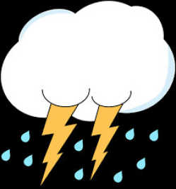
During an evening storm that produced rolling thunder, severe lightning and even some minor hail, there was little apparent damage from the storm, local officials have reported.
While July 14 (Thursday) already has it own historical Hoosier significance as the anniversary of the hottest day on record at Indianapolis -- 106 degrees on July 14, 1936 -- July 13 threatened to rival that in rainfall.
Putnam County received 3.01 inches of rain Wednesday, local weather observer Diana Foust reported to the Banner Graphic.
"From the 'Cocorahs' map, Putnam County appears to have received a bit more rainfall than surrounding counties," she noted. "There was 3.01 inches in my gauge at 7 a.m. (Thursday)."
Shortly before 6 p.m. Wednesday, she reported hail.
"It lasted several minutes but none was larger than a dime and was mostly pea to rice size," Foust added.
The storm did knock out power to the area around Robe-Ann Park for approximately 20 minutes Wednesday evening, but no widespread outage was reported.
Likewise, there appeared to be a dearth of property damage associated with the storm.
David Costin, Putnam County EMA deputy director, told the Banner Graphic there were "reports of tree limbs down, but that has been all."
Flooding did occur in some low areas, although the Putnam County Highway Department reported that only one county road required attention following the storm.
Two miles southwest of Stilesville near the Hendricks-Putnam county line, a construction trailer was reportedly blown over at 7:52 p.m., the National Weather Service reported, while utility lines were reported down at the U.S. 40-State Road 75 intersection.
The three-inch rainfall total adds to a July figure of 2.59 inches for central Indiana recorded prior to the storm. The average rainfall for July is 4.55 inches in the Indianapolis area.