
First measurable snowfall likely on Wednesday
It’s beginning to look a lot like 2020 is finally going to see its first snowfall of meteorological winter in west-central Indiana.
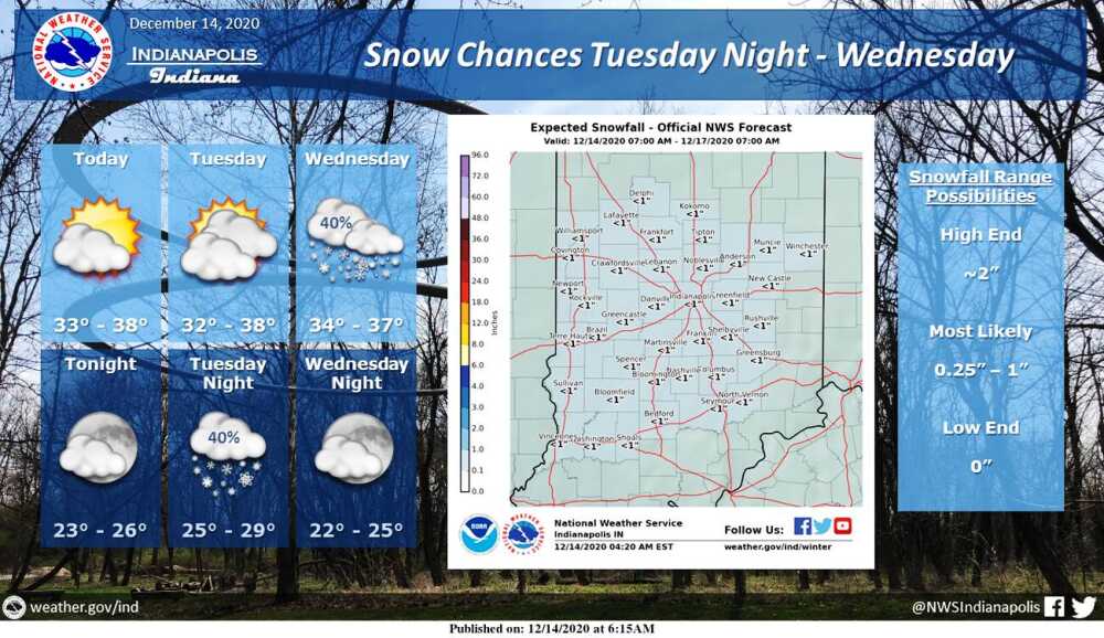
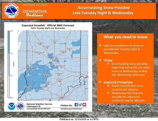
The National Weather Service is predicting about a quarter-inch to an inch of snow to fall Tuesday night into Wednesday across most of central Indiana.
If it happens, that will be almost a month late for the average first measurable snow. Historically, the average date for that occurring locally is Nov. 19.
If that first measurable snow does fall Tuesday or Wednesday, it will mark the seventh latest occurrence in recorded weather history.
The latest date for the first snowfall is Jan. 4, 1941, while more recent occurrences occupy second and third in Dec. 29, 1986 and Dec. 24, 2001.
Another Christmas Eve snowfall, in 1905, holds down the fourth spot, while Dec. 22, 1896 is the fifth latest and Dec. 21, 1998 stands in sixth.
The 2020 first snow would be at least seventh if the forecast holds up.
Meanwhile, in other snowfall facts, the average date of the last measurable snowfall is March 30.
The earliest date of first measurable snowfall in central Indiana was set on Oct. 18, 1989, while the latest date of the last measurable snowfall is listed as May 9, 1923, according to the National Weather Service.